
SOUTHCENTRAL BIRDING TRAIL
About The Area
Marion Reservoir is 6,200 acres in size. The lake is surrounded by another 6,000 acres of public lands consisting of 3,700 acres of mixed native grass and riparian timber and 2,350 acres of cropland. Marion Reservoir is located along the western edge of the Flint Hills in the Cottonwood River Valley.
As with most large Kansas lakes, the most interesting time to visit is during fall, winter and early spring (October thru March). During these months a tremendous variety and huge numbers of waterfowl are present. Canada, Snow and White-fronted Geese as well as all species of ducks found within the Central Flyway are present. And, a good assortment of gulls and grebes usually can be found during these seasons. The parking lot at the west end of the dam as well as four parks and campgrounds provide many vantage points to scan the lake. These parks are Marion Cove on the east side of the lake near the dam; Cottonwood Point farther up the east side; Hillsboro Cove near the dam on the west side; and French Creek Cove farther north along the west shore. Maps are available at the at the Corps of Engineers office at the east end of the dam. The vestibule with the brochure rack is open even when the offices are closed.
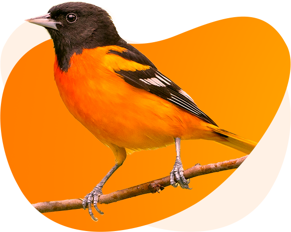
The 1-mile Willow Walk Nature Trail is located along the north edge of the northernmost Cottonwood Point campground loop. This trail also has a shorter half mile loop for those not wanting to walk as far. A storm recently destroyed the trailhead sign. The sign will eventually be replaced, but in the meantime a large cement base makes the trail location obvious. This trail offers a nice mix of birds. Nesting birds include three species of vireo – Red-eyed, Warbling and Bell’s, both Baltimore and Orchard Orioles, and all six species of Kansas nesting woodpeckers. The trail has views of the water and shoreline where waterfowl and shorebirds can be present during migration.
An impressive Purple Martin colony exists right across from the entrance to the Marion Cove Campground where folks have put up several martin houses. The agricultural lands around the reservoir have resident Northern Bobwhite, Ring-necked Pheasants and Wild Turkeys. Dickcissels are abundant in summer and Northern Harriers hunt over the fields in winter. In all, over 300 species have been seen in and around Marion Reservoir, including the first and only Kansas record of Royal Tern which was found here in August 2021.
SOUTHCENTRAL BIRDING TRAIL
About The Area
The 2,800-acre Maxwell Wildlife Refuge offers an iconic Kansas landscape complete with approximately 60 elk and 200 bison grazing on rolling grasslands. This site is a collaboration between Friends of Maxwell and the Kansas Department of Wildlife and Parks. The presence of the elk and bison limit the access, but you can enjoy grassland birds from along Pueblo Road which crosses the refuge. Occasionally the bison are near or even in the road. But the best way to see the bison and elk is to take a tour offered by the Friends of Maxwell. For schedules and reservations see their website: https://maxwellwildliferefuge.com
In summer, Dickcissels are abundant and Upland Sandpipers and Common Nighthawks perch on the fence posts. Grasshopper Sparrows also are common in the grasslands. Listen for their buzzy insect-like song. You may hear the boisterous songs of Northern Mockingbirds and Bell’s Vireos coming from the scattered thickets. Where Pueblo Road intersects small areas of trees it is worth pausing and listening for woodland species.
The picturesque McPherson State Fishing Lake is located on the west side of the refuge. The campground and a nature trail along Gypsum Creek (south end of the campground on the west side of the lake) provide a walk through excellent habitat for woodland migrants and local resident species. Eastern Bluebirds and Red-headed Woodpeckers add brilliant color to any walk through this open forest area.
During migration all of the puddle ducks found in the Central Flyway plus many diving ducks such as Ring-necked Ducks and Common Goldeneye can be found on the lake. Hooded and Common Merganser also are often present during fall and winter. Great Blue Herons and other waders frequent the cattail marsh at the upper end of the lake. This lake famously hosted Kansas’s second record of Great Kiskadee Flycatcher!
SOUTHCENTRAL BIRDING TRAIL
About The Area
The Big Basin Marsh is part of a wetland complex that extends throughout much of the western portion of McPherson County. In all, this wildlife area consists of 51 independently managed wetland pools and two refuges that include 650 total acres and up to 350 acres of water. In total this wetland complex provides 1,750 surface acres of water when flooded for migrating waterfowl. The area is managed intensively for waterfowl, but it also provides good habitat for shorebirds, herons, and other marsh birds. In spring of 2016, 17 whooping cranes were seen here. This marsh complex, divided by dikes, is best viewed by walking the dikes on foot and with knee high boots to keep your feet dry and with appropriate insect repellent in warmer months. The spring migration is especially good for viewing migratory ducks in full breeding plumage. In season, one can expect shorebirds tallies of over 20 species and potentially the full complement of waders including Least Bittern. Summer birding can be difficult due to the dense vegetation and often dry conditions.
SOUTHCENTRAL BIRDING TRAIL
About The Area
Kubin Marshes is part of the Wildlife Area and wetland complex described in the description of the Big Basin Marshes. Much like the Big Basin area to the south, in the appropriate season you can expect a full range of shorebirds and ducks along with waders, including White-faced Ibis. Both American and Least Bitterns occur here. Birding along the roads between Kubin Marshes and Big Basin Marshes and throughout the entire western part of the county can be excellent for shorebirds if there is standing water in the agricultural fields. Again, use caution if the roads are wet. During migration a variety of sparrows as well as other passerines can be seen in the roadside vegetation and around farmsteads and shelterbelts. In the winter Short-eared Owls and Northern Harriers are to be expected. Large flocks of geese, particularly White-fronted Geese, can be seen in the agricultural fields. In early spring they are sometimes joined by Sandhill Cranes and there is always the chance of a Whooping Crane sighting!
SOUTHCENTRAL BIRDING TRAIL
About The Area
Sand Hills State Park was established in 1974 as a 1,123-acre natural area to preserve sand dunes, grasslands, wetlands, and woodlands. The sand prairie which makes up most of the park is a particularly interesting and unique plant community. Eight trails totaling 14 miles in length weave between 10 to 40-feet high sand dunes, through grasslands and cottonwood groves, past woody thickets, and around wet areas. After 40 years, a campground with a pond was added on the south edge of the park. The campground offers modern bathroom facilities whereas the nature preserve portion of the park only has two pit toilets.
A valid Kansas State park permit is required for entry to this area.
This park features open-country nesting birds like Northern Bobwhite, Ring-necked Pheasant, Wild Turkey, Field and Lark Sparrows and Dickcissels. Yellow-breasted Chats, Bell’s Vireo, Indigo Buntings, and Blue Grosbeaks nest in the woody thickets. Common Yellowthroats nest in wetter areas. In the cottonwoods you can find Yellow Warblers, Great Crested Flycatchers, Blue-gray Gnatcatchers, Eastern Bluebirds, Carolina and House Wrens, Baltimore and Orchard Orioles and both species of kingbirds.
During late fall and winter an excellent variety of sparrows occur here. Spotted Towhees, juncos and at least 10 other species of sparrow can be found including the attractive LeConte’s Sparrow.
SOUTHCENTRAL BIRDING TRAIL
About The Area
This 100-acre urban oasis consists of 33 wooded acres managed by the Hutchison Recreation Commission for public use and approximately 70 additional acres of prairie, adjacent to nature center grounds which are accessible to the public for birding thanks to a partnership with Evergy and the Southern Pacific Railroad.
The nature center includes exhibits, a gift shop, science lab and meeting rooms.
Outside of the nature center are butterfly and hummingbird gardens, an innovative playscape for children, and a 1-acre pond which attracts water birds. Birders can explore the surrounding woodlands and prairies by taking advantage of 3 miles of easy walking trails.
This relatively small site is a pleasant place to do some relaxed birding. Canada Geese, Green Herons, Wood Ducks, Belted Kingfishers, Eastern Phoebe and Spotted Sandpipers often can be found around the pond. Common nesting birds include Yellow-billed Cuckoo, Mississippi Kites, Bell’s, Red-eyed, and Warbling Vireos, Gray Catbirds, Brown Thrashers and Carolina Wrens. Migrating warblers can be found long the forest trails during late April and early May and again in September.
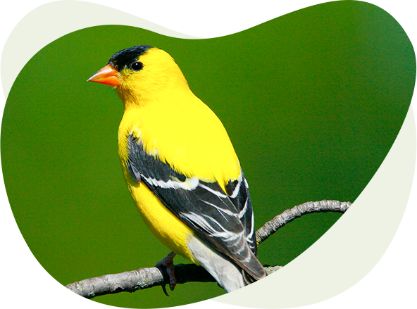
House Finches, American Goldfinches, Black-capped Chickadees, Tufted Titmice, both White-breasted and Red-breasted Nuthatches, and an assortment of woodpeckers visit the very active feeding stations during winter.
SOUTHCENTRAL BIRDING TRAIL
About The Area
This 310-acre park along the Little Arkansas River features riparian woodlands, a sand prairie, a 16-acre lake and a small swimming pond. A good strategy for birding this park is to bird along the Park Road which runs along the river the length of the park from the south entrance to the north entrance. These riparian woodlands are home to Summer Tanagers, Warbling and Red-eyed Vireos, Eastern Wood-Pewees, Blue-gray Gnatcatchers, and even the occasional Rose-breasted Grosbeak. Migrating warblers occur in good numbers.
In more open areas, birds like Indigo Bunting, Blue Grosbeak, Baltimore and Orchard Orioles, Eastern Bluebirds, American Goldfinches will brighten summer bird walks here. Red-tailed Hawks and Mississippi Kites often are seen soaring overhead. American Kestrels, Scissor-tailed Flycatchers, Dickcissels and both species of kingbirds are the common “wire birds” on the surrounding roadsides. In winter this park is home to Bald Eagles, Northern Harriers, Yellow-rumped Warblers and as many as 11 species of sparrows including Harris’s, Fox, Tree, White-throated and White-crowned.
The 1-mile Lakeside Nature Trail is noteworthy for the American Woodcocks that nest here in years when drought has not been severe. Look and listen for them near dusk, beginning in early March and continuing through early June. This trail can be accessed from the Community Center or from the earthen dam at the north end of the lake. Maps are available at the Bait Shop
SOUTHCENTRAL BIRDING TRAIL
About The Area
This 1,300-acre park includes a 314-acre lake. Although the park is intensely developed for recreation with campgrounds, playgrounds and other amenities, the lake itself has produced many sightings of rare birds. Some of the rarities seen have been Red-necked Grebe, White-winged Scoter, White Ibis, Glaucous Gull and Little Gull. During migration one can find both a good variety and high numbers of waterfowl, shorebirds, gulls and terns. White Pelicans and Double-crested Cormorants are often abundant. And, in late summer keep your eyes out for the smaller Neotropic Cormorant as they have been seen here occasionally. All five species of Central Flyway Geese are present during the late fall and winter. Several perimeter roads allow good opportunities for viewing the entire lake.
The Osage Nature Trail which is just north of the lake is the best place to find songbirds. Migrating warblers can be found during spring migration and good assortments of sparrows can be found during winter. Henslow’s Sparrows have nested in the area of native prairie and Smith’s Longspur and Sprague’s Pipit have been seen here during fall migration.
SOUTHCENTRAL BIRDING TRAIL
About The Area
The R. Michael Rhoades Community Wetlands Park is a newly developed birding site that was opened to the public in 2023. The Kansas Alliance for Wetlands and Streams (KAWS) spearheaded the project using funds donated by several public and private partners such as R. Michael Rhoades Foundation, Ducks Unlimited and the Evergy Green Team. This collaboration transformed the land adjacent to an inaccessible wastewater treatment wetland into a dynamic, rainwater-fed wetland park.
The park 7.2-acre park features a wheel-chair accessible walking path to an observation area where you can view waterfowl and over 150 other bird species. Interpretive kiosks and a mural enhance the site’s attractiveness. The larger adjacent wastewater wetlands can be viewed through a chain-link fence.
Common Yellowthroats and Yellow Warblers add color to the marsh during the summer months. In late summer and early fall you can expect to see good numbers of migrating shorebirds. More than 20 species of shorebirds have been recorded here. Herons and egrets are also common during this time.
Geese can be abundant in the fall and winter with all five species of the Central Flyway present. Ducks are also common with dabbling species such as Northern Shovelers, Mallards, Northern Pintail, Gadwall and Green-winged Teal being most often seen. Lesser Scaup, Ring-necked Ducks, Ruddy Ducks, Redheads and Canvasbacks are also frequently reported.